Changes, innovation, expanded education on the horizon for nature preserve
Story by Paul South Photos by Graham Hadley Submitted photos
“Come to the woods, for here is rest.” — John Muir, American naturalist
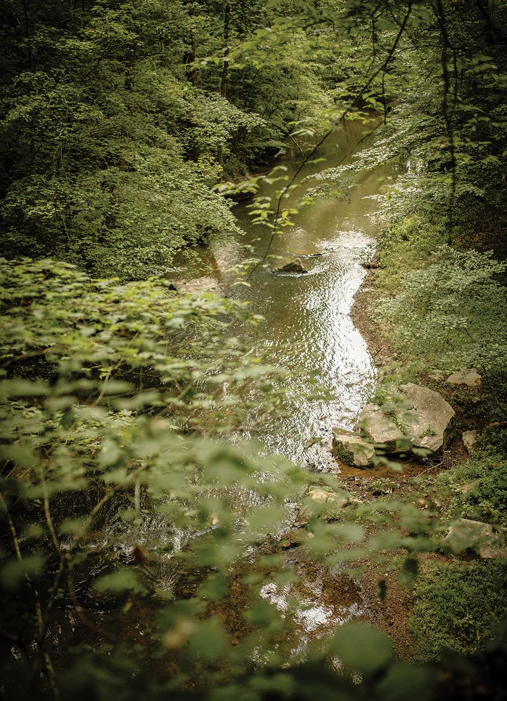
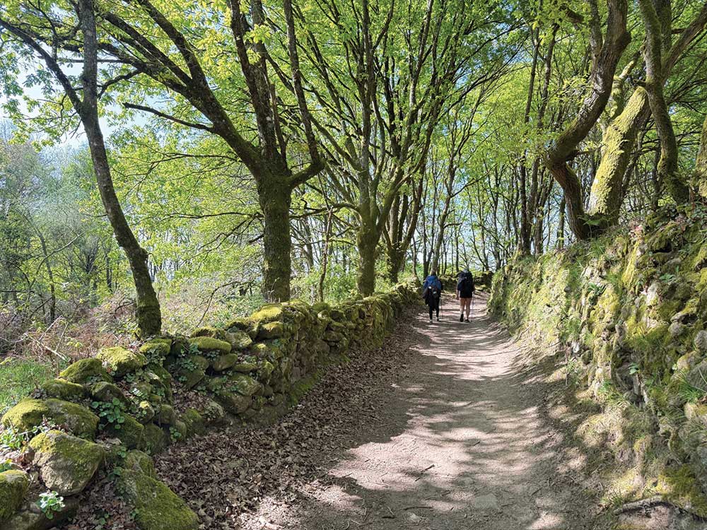
Even in late August on the banks of Big Canoe Creek, change was in the air. Doug Morrison can see it from his side porch as he sips his morning coffee.
Leaves turned red, yellow and gold. Some even surrendered without a fight to the coming autumn. Soon, a crisp chill will be at home in the air, exciting stuff after months of heat and humidity.
But for Morrison, manager of Big Canoe Creek Nature Preserve, nature isn’t the only architect of transformation. There are exciting human changes coming this fall to the 422-acre preserve in Springville, part of Alabama’s Forever Wild lands.
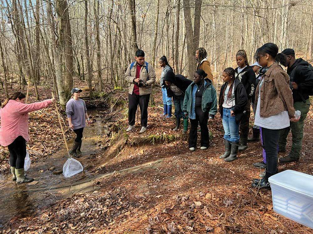
The preserve, one of the most biodiverse parcels of land in the nation’s fourth-most biodiverse state, has a new education coordinator, Auburn University graduate Lucy Cleaver.
“We’ve got endangered species and threatened species in the Big Canoe Creek watershed,” Morrison said. “She will be working with different educational programs. We’re about to light it up and make it happen.”
Local students learning about the animals found in the Preserve
Cleaver, a native of Salem, Ala., holds a master’s degree in natural resource management from Auburn. She assumed her current role in August but has worked for the City of Springville for about three years.
Her work extends beyond the preserve and area schoolchildren, she said, even though she’s already conducted field trips for classes.
“When people think about outdoor education, they think it’s mostly about K-12 groups,” she said.
“But it’s also my goal to reach out to our landowners in St. Clair County. It’s equally important to me to educate them as to what they can do on their own property to help our entire watershed. It’s not just about what’s going on at the preserve. I want to make sure everybody has access to the knowledge that we have.”
Cleaver also plans to partner with entities like The Nature Conservancy, U.S. Fish & Wildlife Service, Geological Survey of Alabama, St. Clair County Soil Conservation District and the Alabama Cooperative Extension Service.
The preserve, which opened in 2024, boasts some eight miles of trails, including one hiking only trail (Creek Loop), two combination hiking and biking trails (the Fallen Oak and Slab Creek trails) and one combination hiking and horseback riding trail, called the Easy Rider trail.
Biodiversity on display
The magic of the preserve’s flora and fauna – even Creation’s s smallest treasures – captures the imagination of visitors.
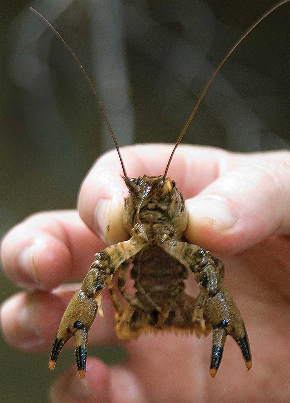
Some examples? Consider the Canoe Creek Clubshell, a freshwater mussel found only in the Big Canoe Creek Watershed and listed as endangered on the Endangered Species List. It’s an important barometer of the health of the creek, Morrison said.
“Mussels are important to the water system because they’re livers for the river because they filter the water,” Morrison said. “They are also good bio-indicators. If they are there, it means the water hasn’t been polluted enough to kill them. Their food source comes from the water and as they ingest the water, they filter the water, thereby cleaning turbid water of sediment.”
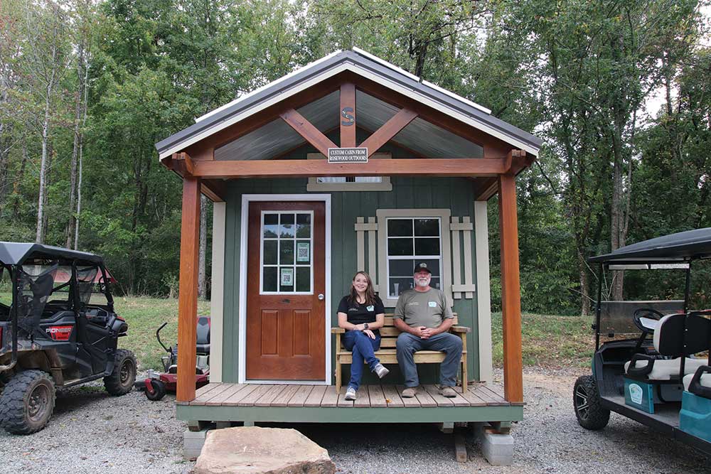
Lucy and Doug at the cabin and preserve office
The tri-spot darter, featured on the preserve’s logo, is a threatened species. It also calls the preserve home. The small fish features three dark saddle-like markings on its back. But during the mating season, males become brightly colored reddish orange and green.
Other aquatic species in the watershed found in a tributary of the Big Canoe Creek Nature Preserve are the Western Blacknose Dace, a creature not documented in the area since the 1980s. A new find, the Gold Striped Darter was recently discovered, which is a rare find above the Fall Line.
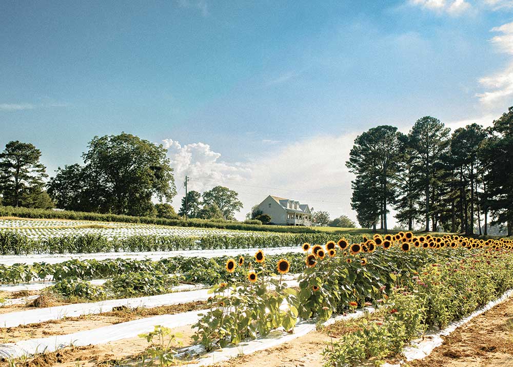
For plant lovers, there are an array of blossoms – Mountain Laurel in the spring and wild azaleas are plentiful. The oak leaf hydrangea has bloomed out for the season. There are stands of Woodland Spider lilies, similar to the Cahaba Lily and a variety of irises and other wildflowers.
In the fall, Morrison said, the resplendent purple Beauty Berries are plentiful. The forest becomes more open as the leaves tumble to the ground.
“There are beautiful, big patches of old hardwoods,” Morrison said. “We have persimmons, paw paw trees, Muscadine.”
The unique finds fit the preserve’s motto, “Explore and Discover.”
An exciting journey ahead
As far as future goals for the preserve, Morrison is excited.
“We’re wide open,” he said.
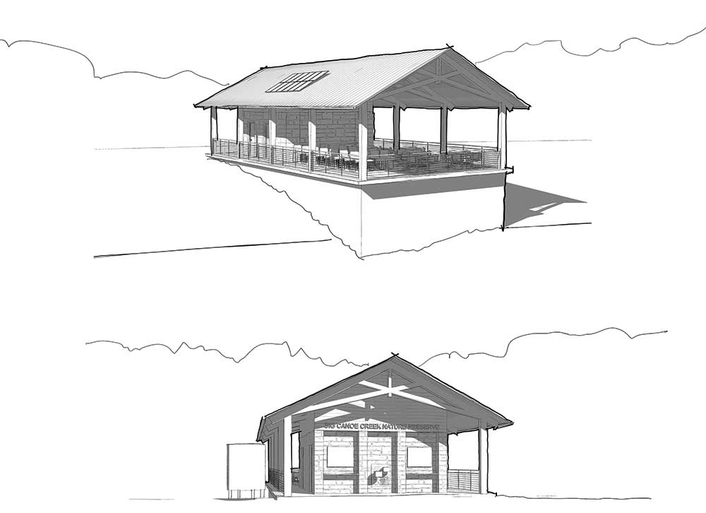
An August grant of more than $335,000 from the Alabama Department of Economic and Community Affairs will help fund the construction of a new open-air educational pavilion. The project will also get a boost of nearly $84,000 in local matching funds.
The new facility will house restrooms, an area to host educational classes and general gathering space.
Initial design renderings of new pavilion
“One of our locals, Mike McCown worked diligently with me and (St. Clair Economic Development Council Grants and Leadership Director) Candice Hill on the grant application. Mike really put a lot of time and effort into this. As a matter of fact, he inserted many links to past articles in Discover (magazine)that I believe helped craft the story. Our journey speaks for itself, a journey of perseverance, faith and huge community involvement. We are beyond thrilled this will be underway soon,” Morrison said.
Also in its earliest phase, a Nature Playscape for kids crafted not from plastic, but from rock and other natural features is planned. It is hoped that the playscape will open in 18 to 24 months.
“We just got the concept plan for that created by Learning Landscapes Design,” Morrison said. “We’re waiting on the projected costs of that, and then we’ll go after grants to help build that. Hats off to donor, G.T. LaBorde, for funding the Concept Plan and coming up with the idea. This design is incredible and will be a big attraction once built. Again, more community involvement.”
Already, Cleaver has scheduled fall field trips with homeschool and other school groups from as far away as Birmingham.
When Cleaver talks about the preserve, she thinks of a spot in Slab Creek where stones like flat dominoes seem to provide a natural footbridge over the water.
“What makes (the preserve) special is there’s nothing else like it in this community,” she said. “We don’t have another nature preserve where people can go for free and go hiking or horseback riding or mountain biking. To me, it’s very special that we offer this to the community.”
With all the happenings at the preserve, Morrison and Cleaver are like kids at Christmas. Cleaver’s addition only adds to the excitement as the preserve charts a course into the future.
“It’s a great journey, and it’s a great job,” said Morrison. “We are beyond grateful for our community support.”
Key part of Chandler Mountain’s rare natural beauty
Story by Paul South Photos by Mackenzie Free
Sometimes nature’s miracles enter our hearts, souls and minds with a bang, like the colors of the Northern Lights, or the Hale-Bopp comet piercing a blue-black sky as it did late in the last century. Both phenomena are greeted by “ooohs” and “aaahhhs,” wows or wordless, wide-eyed wonder.
But more often, time and the elements combine quietly with nature to create something magnificent and mystical.
So, it is with the Chandler Natural Bridge, a place known simply as The Rock Bridge. Located near the base of Chandler Mountain that forms part of the St. Clair-Etowah County line, the natural bridge is one of six named natural bridges and two unnamed spans in Alabama, according to the Natural Arch and Bridge Society.
The Rock Bridge spans Little Canoe Creek. It’s 48 feet long, 54 feet wide and 17 feet thick. The top part of the span is made from Gaspar Limestone. Wind and water erosion sculpted the bridge over millions of years.
Since 2003, Save Chandler Mountain, a nonprofit advocacy group for the mountain, has worked to protect the Alabama’s third-largest peak, which is known as the “Tomato Capital of the World.”
Fran Summerlin, founder and president of the advocacy group, has a special place in her heart for the mountain and for the Rock Bridge. She holds dear childhood memories of her brother taking her to see the bridge when she was only five.
“It was fascinating, I’d never seen anything like it. It was wonderful.”
What made it fascinating?
“There was a big rock that looked like a bridge,” Summerlin said.
“When you think of natural bridges all over the country, they’re always revered,” she said. “People love going and seeing them. (The Rock Bridge) was formed by water, and it’s a fascinating place.”
She talks of Alabama Power Company’s unsuccessful plans two years ago to build a hydroelectric dam there, a move that drew vocal opposition from residents, environmentalists and Native American groups. “If the power company project had gone on, it (the bridge) would have been covered with water,” Summerlin said. “It would have been lost.”
In August 2023, Alabama Power withdrew its application to the Federal Energy Regulatory Commission to operate a Pumped Storage Hyrdro facility at Chandler Mountain.
Locals now have a heightened sense of the mountain’s importance. Darrell Hyatt, too, has precious memories of the bridge – picnics, swimming in the creek and exploring the area. “It should be a state park,” Hyatt said. “It’s beyond comprehension that anyone would consider destroying it.”
Summerlin said Save Chandler Mountain is continuing to research the area and work to find historical and archaeological treasures on the mountain. “We will continue to do that and continue to hope that (the utility) would come to some conclusion that the land needs to be preserved.”
Seth Penn is an environmental and political activist and enrolled citizen of the Cherokee Tribe of Northeast Alabama. While he couldn’t speak specifically about the significance of the Rock Bridge to indigenous peoples, generally speaking, natural arches and bridges often have sacred meaning for Native American tribes, who often see natural bridges as portals to the upper and lower spiritual worlds.
“I don’t know a lot of specifics about that specific natural bridge itself to really give you a lot of insight,” Penn said. “I can tell you that a lot of natural bridges … and special occurring rock features such as that which occur on the landscape are often seen as portal-type places, meaning they are significant to various indigenous tribes. And often, those are places where certain ceremonies or prayers will be conducted because they do believe sites like that have special spiritual significance.”
Rich Beckman, Knight Chair of Journalism Emeritus at the University of Miami (FL), is president of the nonprofit Natural Arch and Bridge Society. Formed in 1968, the 200-member organization works to protect natural arches and bridges and promote the study, appreciation and preservation of the natural structures.
While the NABS is small compared to other environmental groups like the Sierra Club, Beckman said the organization can “raise a ruckus” when natural treasures like the Rock Bridge are threatened.
“We don’t preserve natural arches, but we do try to help them live out their life cycle without abuse,” he wrote in an e-mail. “So, we are concerned about any planned or criminal destruction by man.”
The NABS joined locals and indigenous peoples to oppose an Alabama Power plan to build a hydroelectric power facility on Chandler Mountain, a proposal opponents of the plan argued would flood Chandler Mountain and leave the natural bridge underwater.
In the face of opposition, the utility withdrew its Federal Energy Regulatory Commission permit request and shelved the proposal, at least for now.
“We certainly let the utility know of our disapproval,” Beckman wrote. “(The Alabama Power proposal) would have been a disaster.”
The land where the bridge resides is fenced off by Alabama Power and closed to the public.
However, a portion of the utility-owned land on the mountain is open to hunters under Alabama Power’s hunting license program.
In an email, company spokesman Joey Blackwell wrote, “Through this program, parcels of land across the state are awarded through a public auction program,” Blackwell wrote. “Once a hunting license is awarded to a particular hunting club, the property can only be hunted by its members and guests.”
The utility makes some of its land holdings available for public use, including public access points across 13 reservoirs in partnership with local and state agencies, Blackwell said. The hunting license program is one of those initiatives.
Blackwell defended Alabama Power’s land use practices. “Alabama Power manages its St. Clair and Etowah County property holdings in the same way we work to be good stewards of land across out state,” Blackwell wrote. “Alabama is one of the most biodiverse states in the country, and experts in forestry, biology and wetlands management work together to protect our natural resources.”
Meanwhile, Save Chandler Mountain’s preservation work continues. How can citizens get involved?
“There’s power in numbers,” Summerlin said. “They could join Save Chandler Mountain, get on our Facebook page. We continue to strive to preserve this land. Just get involved with us.”
Hyatt said the mountain and the Chandler Natural Bridge are important, not to be taken for granted. “I was in awe of it, even as a child,” he said. “I didn’t really appreciate this place then as much as I do now. The older I get, the more it means.”
What would Summerlin want people who had never seen the Chandler Natural Bridge to know about the span?
“It Is s magical place,” she said. “It deserves to be preserved. In fact, all of this community and this area deserve to be preserved because it is a holy place for the Cherokees. It has incredible historical significance, not just for the indigenous people, but with, for example President Andrew Jackson took the land and either sold it or granted deeds to people.”
Some descendants of those original recipients still have those deeds, Summerlin said.
“This is a very historically significant, culturally significant, and I would like to say, it’s a sacred place.” l
Editor’s Note:For more information about Save Chandler Mountain, contact Fran Summerlin at fransummerlin@att.net, or visit the Save Chandler Mountain Facebook page or on the organization’s website, savechandlermountain.com. Dues are $20 annually.m to keep our programming fresh, giving people a reason to come and come back again to discover our rich history.”
St. Clair Agriculture & Multi-Event Center is so much more than original rodeo venue
Story by Elaine Hobson Miller Photos by Mackenzie Free Submitted Photos
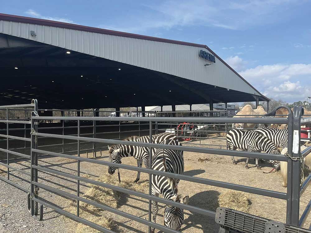
The St. Clair County Arena in Odenville has been home to rodeos and agricultural shows for many years, but today, it is so much more. Over the past 12 months, it has hosted a dog show, a vintage market, a circus and a county fair.
The Event Center next door is a pickleball mecca to rival any courts in the county.
In other words, the Arena ain’t just a place for agricultural shows anymore. The official title may give a hint to the depth of its overall scope: St. Clair Agriculture and Multi-Event Center.
“We wanted more than just an agricultural center,” says County Commissioner Jeff Brown. “And that’s what we have. We can do a dog show one day, a circus the next. I give (Arena Director) Ashley (Hay) a ton of credit. She’s easy to work with. The original board that ran it needs credit, too. It started from nothing.”
Dog agility show
The county bought the Arena, 25.6 acres of land and an office building in 2010 from Randy and Michelle Spence for $551,197. For 11 years, it was used for rodeos and other horse-related events. During COVID, the county received a $1 million federal grant to build an emergency facility, called a Pandemic Center, that they could operate from in the event of a natural disaster. That grant changed everything.
“I came aboard in 2021, and the grant had already been awarded,” says Hay.
“The county commission looked for a way to use the grant to best help the entire county. Only the Arena was here then.”
Hay says that grant required a large, unobstructed space, restrooms, as well as storage to be utilized by EMA. The county commission looked for ways that the facility could be used for more than just emergencies, though. This led to the addition of a sport-court surface, bleachers, retractable basketball goals and equipment for volleyball and pickleball in the Event Center.
“This building was attached to an existing older building that had administrative offices and the cowboy church,” says Hay. “The concession stand with restrooms and showers was built a while ago.”
Both the Arena and the indoor, 12,000-square-foot Event Center are membership facilities available to anyone. “We have a lock box for daily use, or you can sign up online. We have about 100 members right now. The cost is $100 for an annual membership, but daily memberships are obtainable, too.”
Pickleball players have five days a week to play their favorite game. “They are pretty dedicated folks,” Hay says. “And they say ours is one of the nicest facilities within 100 miles. We have pickleball classes, but we don’t have programs, so we’re able to offer more open gym time.”
The Event Center offers summer membership for kids, too. The Center’s Facebook page is the best place to check out the schedules.
“We’re the only arena in our area that I know of that allows open rides as much as we do,” Hay says. “Horseback riders can come any time between 6 a.m. and 10 p.m. When they register, they get access to opening the gates. We have 80 horse-riding members. One woman comes with her baby at 6 a.m. because it’s the only time she can.”
Early history
Originally, the county created a parks and recreation board to run the facility, appointing Lude Mashburn of Odenville, the late Hershel Walker of Argo, Don Smith of Springville, Brad Sanders of Odenville and Kenny Womack of Riverside as members. A couple of years later, Womack was replaced by Jimmy Hollander, also of Riverside. The board elected Mashburn as chairman.
Zebras and camels visit with circus
“The county had a vision, and they appointed the board to run it,” says Mashburn, who was an agricultural science teacher at St. Clair County High School at that time. “They turned everything over to us, and we ran it. We put in the dirt for the Arena floor, bought a tractor to keep it compacted during rodeos, all that. But the county never funded it for the 10 years we had it, except for building the restrooms and the bleachers. Then things kinda changed when the county got COVID money.”
The board was officially dissolved on February 10, 2022, and the property and facility are now funded and managed by the St. Clair County Commission, according to County Administrator Tina Morgan. Board members at the time of dissolution were Chairman Lude Mashburn, Jimmy Hollander, Brad Sanders, Candi Jones and Donnie Smith.
The county covered the bleachers and Arena, added lights and industrial overhead fans. The bleachers seat 800, with extra seating brought in for rodeos, pushing that total to 1,200 seats as needed. The Arena itself is 22,000 square feet. “In March, April and May, then again in September, October and November, there’s an event every weekend,” Ashley Hay says. “We have had car shows, a community yard sale, barrel racing, ranch sorting, a pig squeal and a county fair.”
Youth timed events such as barrel and pole races and goat tying are still held there. “We have more equine events than anything else at the Arena,” Hay says. “We also have lots of banquets in the Event Center. We’re working on grants for developing the 12-15 acres at the back of the property, including a multi-use trail for walking, horseback riding and bicycles. We also want to do RV hookups so folks can park for the time they are in a show.”
Local youths take part in Pickleball Events Group clinic
Hay’s background is in parks and recreation, having worked for the city of Springville before St. Clair County. Originally from Kansas, she moved here in 2018 because her husband is from Alabama. “I was a high school volleyball and basketball coach, then got into parks and recreation after that,” she says. “I really enjoy it. I started and grew the parks and recreation program in Springville. Then they asked me to do the same here.”
Under Hay’s management, the facility has added a wash bay, industrial fans, lighting, an uncovered, warm-up pen behind the Arena, and everything inside of the Event Center. It has improved parking and upgraded the PA system, too. Hay added a Facebook page and advertisements on Radio Station 94.1. “I feel like things are running well,” she says. “We’re trying to expand the types of programs we have.”
Besides all the public functions, the Arena and Event Center are available to rent by individuals for volleyball and basketball games, for wedding receptions, banquets and other private events. “We have had a wedding, and they brought horses,” Hay says. “The wedding was in the back pasture, and the Arena was where they held the reception. It’s a $750 fee for two days’ rental, and that’s dang cheap in comparison to other facilities of similar size.”
The Arena hosted a circus in February 2025, and the Gala of World Horses in the Fall of 2024. “The Gala had never been to Alabama before,” Hay says.
At least two dozen trailers were parked outside the Arena for a recent Buckle Series, a barrel racing event. Several horses stood tied to trailers, munching hay from their hanging bags. Riders walked their horses in circles, getting them ready for the event. One of those riders was Emmaline Puckett, 9, of Ashville. She has been racing since she was five or six, and like most of the other competitors, usually comes early to put her horse through its paces.
“We’re members here, so if the weather is bad, we come over here to practice barrels,” says Emmaline’s mom, Christina Puckett. “We’re very thankful for this place.”
Tyler and Jayclyn Cobb of Blount County came to watch the barrel race, even though Jayclyn couldn’t compete as usual because her mare has been bred. “We love coming here, Jayclyn says. “It’s covered, shaded, not as hot as other places.”
“A lot of people have really done a great job with the Arena from the get-go,” says Commissioner Brown. “The board members deserve a lot of the credit. We (the county) had the ideas, and they made it happen.
“That board served for free, put in a lot of hours, even parked cars during events. They deserve all the credit.”
For many, the mention of Chandler Mountain brings to mind images of big, beautiful, savory tomatoes. But the roots of the mountain’s history run far deeper than those lovely fruits or even of those families that have farmed them for generations. Archaeologists are now calling the mountain a place of profound Native American cultural significance, having documented several sites on and around the mountain.
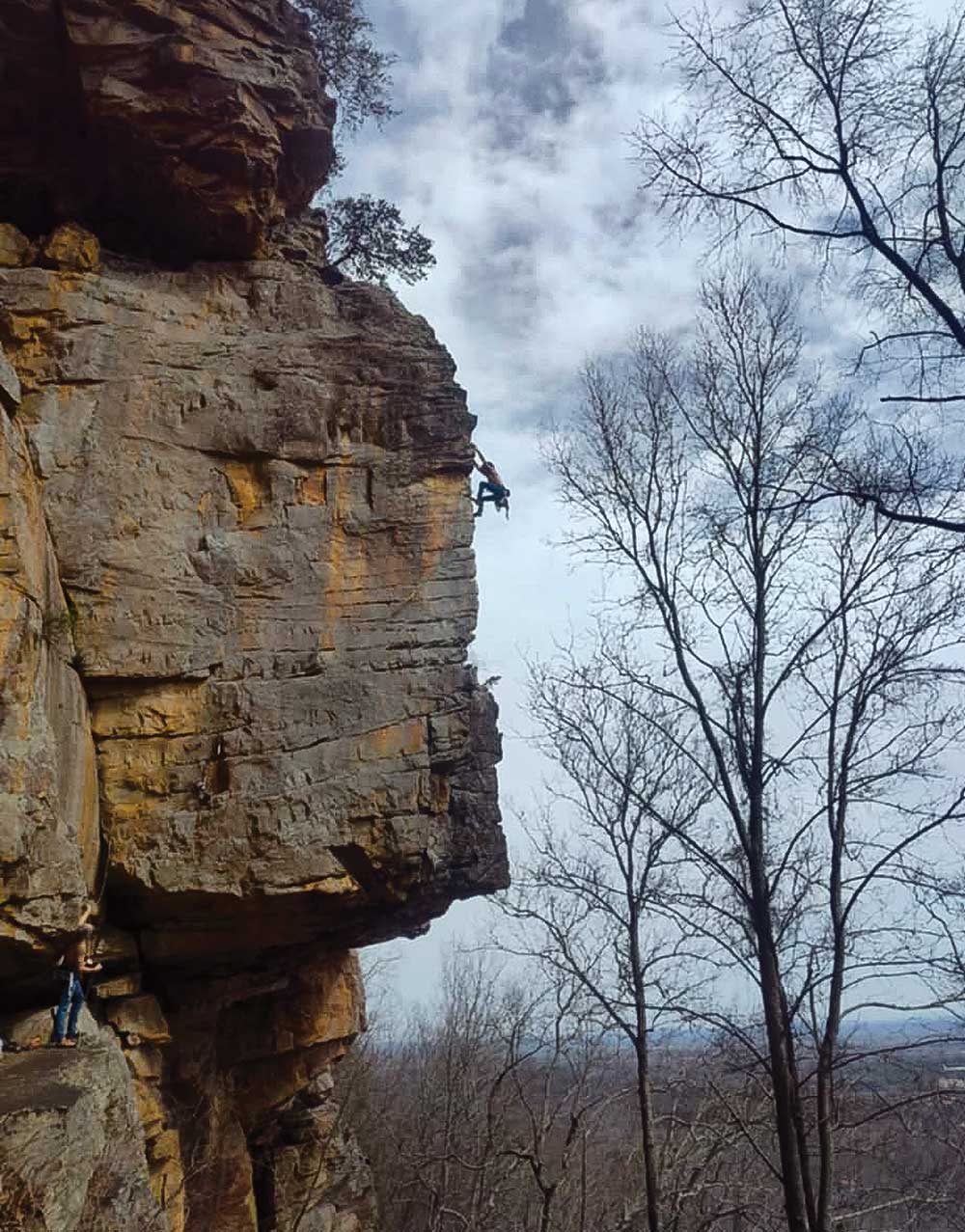
Climbing the rock face on the mountain
These sites, formally verified by archaeologists over the last two years, include pictographs, which are paintings on stone using the pigment, called red ochre, found in the dirt. There are at least eight documented sites containing pictographs, cairns, snake walls and other various rock formations attributed to the area’s Native American heritage. Next month, archaeologists are planning to visit an additional five areas that may also contain significant indigenous findings.
Those culturally significant Native American findings were instrumental in saving Chandler Mountain residents from the fallout from a proposed Alabama Power dam project. Alabama Power had planned to build a pumped storage hydroelectric facility that would have pumped water from Neely Henry Lake up the mountain to a reservoir and dam at the top, the intent of which was to created electricity by releasing water at peak use times to flow down the mountain to four dams below.
The building and operation of the project would have forever changed the landscape of the mountainside and residents banded together to fight. They created Save Chandler Mountain, a 501c3 non-profit, and began working to build a case to oppose the dam project. “The project was a net-negative program, meaning it would have used more energy than it created,” said Fran Summerlin, the organization’s president. “It was going to get rid of so much farmland and so many houses.”
Summerlin explained that the organization reached out to archaeologists and cultural heritage people and found common ground with the people who originally lived on the land, members of the Cherokee Tribe of Northeast Alabama. Both current residents and the Indigenous people of the area were desperate to save the land and protect its features.
Seth Penn is a member of the Cherokee Tribe of Northeast Alabama and was, at the time of the proposed dam project, the southeastern coordinator for the Indian Nations Conservation Alliance (INCA). Fighting to promote Native American culture and to protect sacred sites was his mission and that dovetailed well with Save Chandler Mountain’s mission. Penn, who has degrees in both cultural anthropology and natural resource conservation management, with minors in Cherokee studies and language, lives in north Alabama, but has ancestral ties to both Etowah and St. Clair counties.
“Chandler Mountain and that area was a place where multiple tribal territories came together,” Penn explains. “You had the Cherokee people, various branches of Muskogee, as well as Choctaws and Chickasaw too. This was a special place where various tribes would come together to trade and to talk through things and to try to work things out peacefully.”
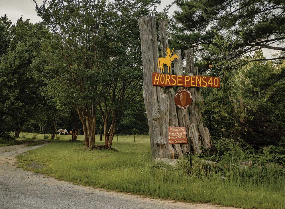
A popular destination – Horse Pens 40 – for bouldering, entertainment, festivals and views
So, their work together began by inviting noted archaeologist David Johnson to visit the mountain. Johnson, who is from Poughkeepsie, New York, had successfully documented Native American sacred and ceremonial landscapes along the lower Hudson Valley, which was instrumental in saving Split Rock Mountain, a land sacred to the Ramapo Munsee Lenape Nation. “We were having a ceremony celebrating the saving of Split Rock Mountain and Seth Penn and his mother came from northeast Alabama,” said Johnson. “I walked him around that site and showed him the stone features. He said I needed to come to Alabama.”
“I made the drive down to Huntsville and met with Seth’s tribe,” Johnson continued. “Within the first two days, we found two ceremonial landscape sites that the Cherokee Tribe of Northeast Alabama knew nothing about.” It was at the presentation he gave to the tribe about his findings that he met some visitors who came up from Chandler Mountain. “They asked me to come look and I went down for two days for a quick look. What I saw was enough that I went back and have documented eight major sites there.”
The shape of the mountain itself is unique in that, unlike typical mountains that rise to a peak, the top of Chandler Mountain is a plateau, flat at the top with a dip, or bowl in the middle. The shape is a natural occurrence, formed during the creation of the Appalachian Mountains hundreds of millions of years ago. The flat top made the mountain ideal for the ceremonial and tribal activities, according to Johnson, with plenty of room for tribes to meet, to trade, to work through disputes, and to pray.
The mountain is known as the tomato capital
“You don’t usually find a lot of artifacts at this type of site,” says Johnson. “You don’t find a lot of broken arrows and firepits because that’s not what they did here. This was a special place, a sacred place.” Those types of artifacts, he explains, are found in habitation sites, archaeological sites where cultures lived and slept.
“There are ceremonially significant places on the mountain, as well as in the whole region,” Penn explains. “There are places where you see the presence of that confirmed through various rock formations, art, and things along those lines that are centuries old. It affirms the long-lasting presence of Indigenous people there.” It’s a place that local Native Americans still go to pray. “We go to these sacred places where we are able to stand in present time, but lock arms with our ancestors, the ancients, to pray.”
The land is sacred, too, to those who live and farm the land today. “There are places there with history, with stories, with blood, sweat and tears that have been poured into that land,” Penn continues. “If that dam project had happened, it would have erased the history of Indigenous people from thousands of years ago, but would also have erased a lot of history from the present inhabitants of that land and their families.”
Charles Abercrombie’s family is deeply ingrained in the history of the area. For more than 75 years, he has lived on land on the side of Chandler Mountain that was once part of the homestead of Joel Chandler, for whom the mountain is named. Chandler received the land as payment for his work as a soldier in the Creek Indian War. Abercrombie still has the land grant signed by Andrew Jackson. The land has been owned by the Abercrombie family since 1894, and Abercrombie says he would fight to protect his land from any threat. “When all this started, I went to an eminent domain attorney,” Abercrombie said. “I was willing to go to the Supreme Court, if I had to.”
He did not have to go to the Supreme Court. As a result of feedback from residents and pushback from Twinkle Cavanaugh, then Alabama Public Service Commission president, the application for the Alabama Power dam project on Chandler Mountain was withdrawn and the mountain, with its beautiful landscape and rich history was saved.
“Bringing these potential cultural losses to the forefront may have contributed to the demise of the project, but important political opposition is probably what made the difference,” says Terry Henderson. Henderson, whose family has been around the mountain and Canoe Creek since around 1850, has lived on the south brow of the mountain for two years. He is married to Linda Derry, a professional historical archaeologist, and worries as much about “unrestrained and uncontrolled visitation” in the area. “These properties, structures, and vistas should be protected through legal, enforceable, verifiable development and access restraints,” says Henderson.
Ben Lyon agrees. He was drawn to the mountain as a rock climber 20 years ago and has lived there for the past 12 years. His property contains red ochre drawings and other findings important to Native American culture. “I believe it’s as important as anything to preserve these,” says Lyons. “It’s one of the few examples of pre-Woodlands depictions in the Coosa River Valley.”
Lyon says saving the mountain and its cultural history is important for the future of the children and for the families who make their living on the land. “There’s a way of life on Chandler Mountain that would have been lost, and about a third of the mountain would have been lost,” said Lyon.
Chandler Mountain is a place of tranquil beauty, a place where families live off the land and spend time in the outdoors. It’s a land of history, of promise, and carries with it the burden of conserving it for future generations. Conservationist Aldo Leopold stressed the importance of that responsibility when he wrote, “The oldest task in human history is to live on a piece of land without spoiling it.” Together, the mountain’s current residents and those representing their Indigenous predecessors have made sure this sacred mountain will not be spoiled.
Pell City resident makes the journey of a lifetime
Story by Paul South Submitted Photos
For the pilgrims who annually flock to Spain from around the world to walk all or part of the Camino de Santiago, the reasons for their journey are as varied as they are.
For the hikers, it can be a trek of faith, fellowship, revelry, reflection, exploration or a communion with God and nature. Known as the Way of St. James, it might well be a tour mixing all of the above, ending at the Cathedral of Santiago de Compostela in northern Spain, where it is believed the remains of St. James the Great rest.
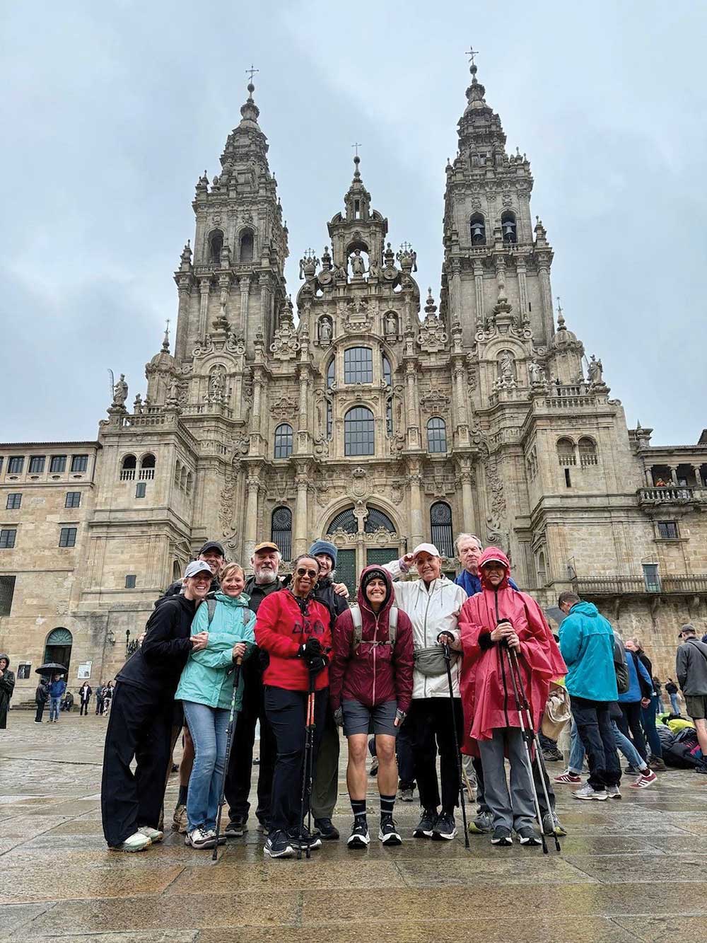
They made it! Cathedral of Santiago de Compostela
For Jean Barnett of Pell City, her 70-mile, weeklong journey on a portion of the Camino Frances or French Way, was a moveable feast of all of the above. The spark for her journey was first ignited by her yoga instructor, Terri Sellers, a five-time veteran of the journey, who was organizing a Camino trip for a small group of friends.
“I heard her talking about walking across Spain, going on this pilgrimage, and I was intrigued. I’d heard of it many years ago, and I decided if I didn’t do it now, I might never do it,” Barnett said.
Multiple reasons fueled her desire to tackle the journey.
“The challenge drew me in,” she said. “But the opportunity to do it with friends who were like minded attracted me to it.”
It came at a time, too, when she had wrestled with family health challenges.
“(The Camino) was just something I felt like I wanted to experience – to get back out and spend some time exploring and doing something that sounded challenging but was doable,” she said.
And there was the spiritual side.
“People have a lot of reasons for doing it, and mine was somewhat religious,” she said. “But being out on the trail gives you a chance to really meditate and have an opportunity to just kind of be with yourself paired with many opportunities for fellowship along the way. But I took time to pray and listen to the sounds of nature, which was one of the things I really loved – the early morning walks, listening to the bird calls, just the sounds of the world waking up.”
She added, “To be out there in a place where you could just be by yourself and think.”
And there were times of fellowship with her group and with other travelers along the road.
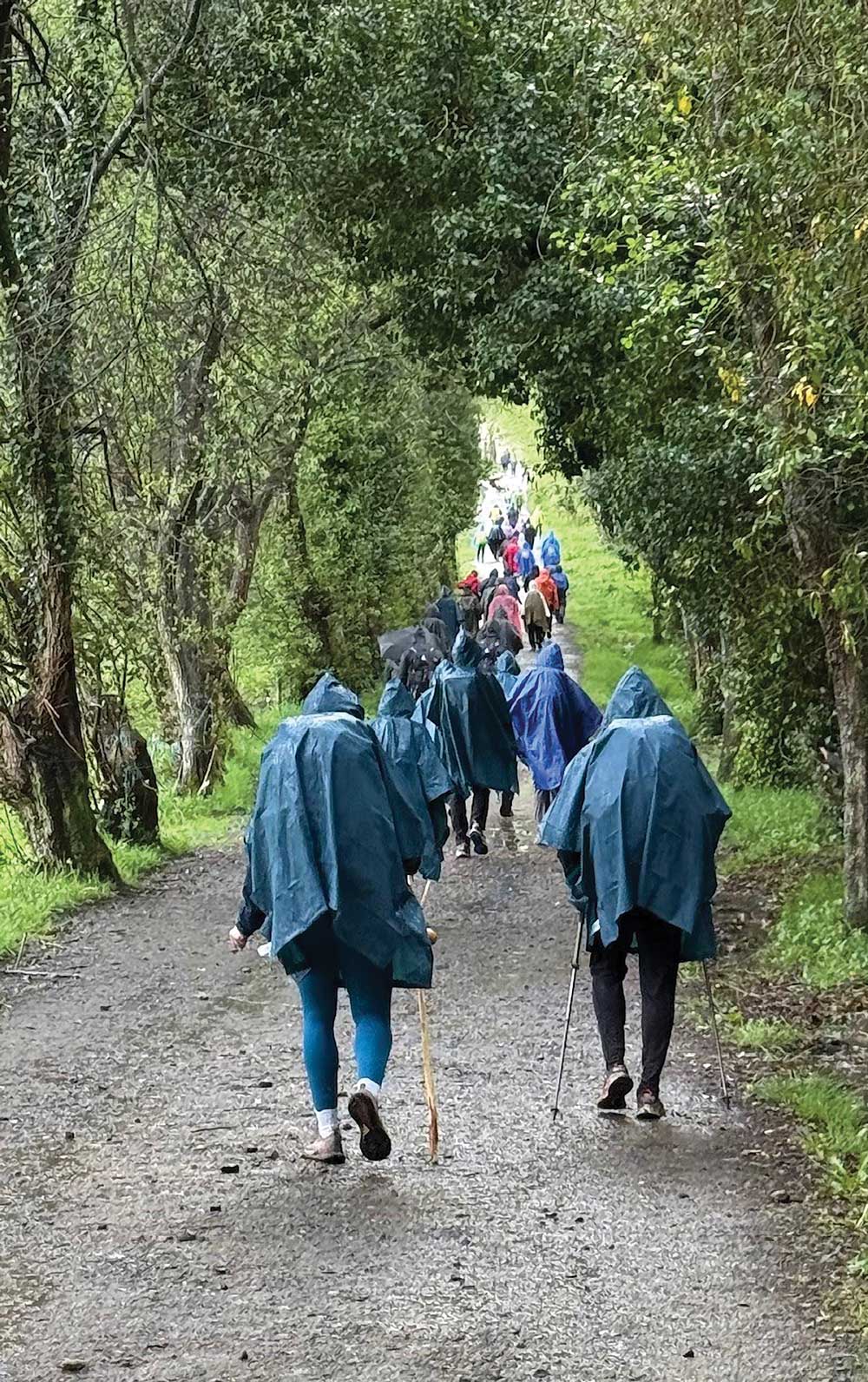
Rainy walk with crowd of Poncho-clad pilgrims nearing Santiago
“There’s a balance there,” she said.
Barnett, a former runner who competed in half-marathons, moved at a more deliberate pace in her pilgrimage. Deep reflection, introspection and fellowship don’t move at a racer’s pace. Camino de Santiago is an opportunity to escape from the daily grind.
“It’s something of a distraction that takes you out of your role in day-to-day life and the chance to just kind of contemplate the world and your purpose,” Barnett said.
Amid the deeper moments, there are the earthlier concerns, from fatigue to blisters on the trail. “You just take every day as it comes and deal with it,” she said.
What is theCamino de Santiago?
In 820, a tomb was discovered in Galicia believed to be the final resting place of St. James the Great. According to “The Camino de Santiago Survival Guide,” while the details are a bit fuzzy, the “Camino” was the beginning of Christian pilgrimages. It is believed that in 920, a Frenchman, Bretanaldo, was the first foreigner to walk the Camino. Some 438,683 people completed the Camino via a network of different routes and via different means. While nearly 95 percent of travelers walk the Camino, others travel via bicycle, horseback, sailboat, on crutches or in a wheelchair.
One interesting note: Some famous people have made the pilgrimage, including the King and Queen of Belgium, television host Jenna Bush Hagar and the acclaimed actor Martin Sheen.
There are several different routes for the Camino, all ending at the Cathedral de Santiago. As they get closer to Santiago and the Cathedral, they merge into one trail, crowded with pilgrims. Here is a glimpse of the trails, taken from The Camino De Santiago Survival Guide:
The French (Frances) Way: This is the most commonly taken route of 780 kilometers from Roncesvalles to Galicia. This route passes through Pamplona, famous for the Running of the Bulls, written about in Hemingway’s The Sun Also Rises.
Barnett and her group began their 70-mile journey in the town of Sarria.
The Northern (Norte) Way begins in Irun and passes through Bilbao, San Sebastian and other towns before entering Galicia.
The Primitive Way: Beginning in Oviedo, this 321-kilometer journey merges with the French and Northern routes near the end.
The English Way (Ingles): The route, which begins in either Coruna or Ferrol and ends in Santiago is named for the pilgrims who originally traveled from the United Kingdom. The distance from Ferrol is 110 km. From Coruna, the distance is 75 km.
The Portuguese Way begins in either Lisbon, or more commonly in Porto. The inland route from the Portuguese capital Lisbon is 600 km, 620 km by the coastal route. From Porto, the inland trek is 230 km, 260 km the coastal way.
The Via de la Plata: The 1,000 km route begins in Seville, Spain and runs inland before arriving in Galicia.
Preparation and an early challenge on the trail
While others will travel all of one of the routes and “rough it” along the way, Barnett’s group traveled with a support van. Hotel reservations along the route were made in advance.
There were checkpoints along the way offering water and snacks and stops for lunch and dinner. Their luggage was also transported. It was somewhat akin to sherpas who aid hikers on an Everest journey.
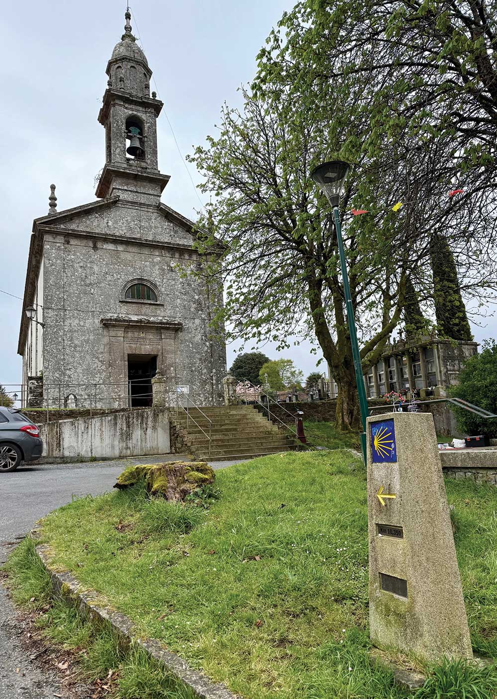
One of the path markers outside
historic church
“I’ve heard it referred to as “Pilgrim Lite,” she said. “We really did have a lot of support along the way, which made it really doable.”
The Camino requires preparation physically, mentally, spiritually and emotionally.
“You know, I don’t think I adequately prepared for it, actually. I was so busy with everyday life and the things I had to do to make sure while I was gone my family was taken care of,” she said. “There was a lot I had to take care of before I could get away.”
At home, she’s also involved at her church, Pell City First United Methodist in trying to help it grow, and she was in rehab for a back injury for six weeks before the trip.”
“I wasn’t as adequately prepared as I needed to be – spiritually, mentally, any of that,” Barnett said. “The therapists helped me get to a point where I could do it without suffering too much.”
The biggest physical challenge came shortly after the long flight from the States to Europe. “On the first day, I got scared,” she said. There was swelling in my lower legs, and the trail was hilly with long inclines and declines. I had a hard time keeping my heart rate down because the swelling was putting pressure on my heart … I wasn’t sure I was going to be able to do it. I just had to take it very slow.”
A pair of compression socks saved her journey. Asked if that first day was the hardest on her portion of the Camino Frances, Barnett said, “Absolutely, it was. After that first day, it wasn’t a problem. But it was still very challenging. That’s a lot of miles, and it was hilly.”
That first day caused her to consider giving up, but the support and advice of her group kept her going. “I was ready to try again,” she said. “I didn’t want to give up.”
A favorite memory – moss-covered stone walls on a tree-lined path
For Barnett, the journey was part solitude, part introspection, part fellowship and more, a hybrid of all the reasons travelers make the pilgrimage. She and her group entered Santiago on the Thursday before Easter. After completing her Camino, she attended Easter Mass at the Cathedral of the Assumption of Our Lady in Porto, Portugal.
“It was amazingly beautiful and spiritual to celebrate in Porto’s majestic ancient cathedral,” she said.
While that may have been the spiritual climax of her trip, Barnett also encountered inspiration in human form. A pilgrim in front of her was walking slowly, with difficulty.
“As I got closer, I realized he was walking on crutches and carrying a backpack,” she said. “It occurred to me, that whatever issues I had or have in my life, I don’t have crutches. For him to take the journey and make it happen, it just touched me. He was my hero.”
As she came alongside the man, she spoke to him.
“He had the most joyful, radiant smile,” Barnett recalled. “He had some age on him, but here he was doing something that most people on crutches would just consider impossible. And he was happy.”
There were other surprises on the walk. Musicians, alongside the trail, buskers who would happily take a Euro or two tossed into an open cello or guitar case, serenaded pilgrims. Groups of young people sang joyfully or laughed as they walked. Barnett encountered fellow pilgrims from around the world, on the trail and in bars and cafés in the villages along the route.
Nature offered signs of spring and of renewal, a pasture full of lambs or calves.
“It gave me another thought, to take this this time and think about the future and the importance of having this life and how you spend your time,” Barnett said.
As she passed centuries-old buildings, Barnett considered the early pilgrims in ancient days who made this journey.
“They did not have the modern conveniences we have – the high-tech shoes and gear – all the things that we access so easily. What did they do when they had issues? … We have so much.”
A favorite memory for Barnett is when she walked a tree-lined path along a stone wall covered in moss. “The moss was glistening, and it looked like carpeting in the shape of the rocks of the wall,” she said. “It was leading you from where you’ve been to where you’re going. It was a gorgeous, magical fairyland.”
She also warmly recalled the fragrance of a eucalyptus forest, ancient buildings, lovely murals. The Camino experience left her forever changed.
“It gave me a chance to focus on what’s important in life. We get so tied up in the daily routine, grocery shopping and cooking meals, and (the trip) gave me a chance for an inward focus, to think about the things that are important in life and relationships and this big world. There are so many places to go and people to meet. It’s eye opening.”
It helped her realize that “being on the Camino is a lot like life. You have to do what you need to do to get from Point A to Point B each day. But in this scenario, you are in nature all the time.”
And at each day’s end, as she laid down to sleep, she remembered the people, places and things she saw – welcoming people in breathtaking, yet peaceful places.
“It was a good time to take a pause in life, even though I was in motion most of the time. It was a pause for your mind to open up more to the spiritual aspect. Being outside. Communing with nature. Thinking about this wonderful world and God and what He has created for us and the responsibility that comes with preserving it.”
The Camino also impacted her perspective on the world.
“I wasn’t bombarded with news, but staying out of the daily news was good for my soul and good for my mind. (In the news), there’s always the bad and negative things going on. The Camino forces you to focus on the good and the beautiful.”
And when she arrived with her fellow pilgrims at the Cathedral of St. James the Great, she was greeted with cheers and applause. She wept with joy at the memory. They were there with pilgrims who had trekked the entire Camino de Santiago, but that did not dampen her triumphal entry.
“Oh my gosh, that was exhilarating,” Barnett said. “It was pouring rain off and on all day, and it was raining when we got to Santiago. But we were so excited to see the cathedral, to end the journey. About 10 kilometers out you could see the spires of the cathedral. I get goosebumps just thinking about it. It put more energy into our final few steps. … The energy level was amazing.”
It impacted her relationship with God.
“When I feel close to nature, I feel close to God. It’s an opportunity for a conversation with God. It was an opportunity to pray and to meditate while listening to nature.”
She thought of nature and art and history along the way – and the pilgrim on crutches.
“I felt blessed to speak to that man who was making his way at his pace with this huge smile on his face, and it made me think how blessed I was to be able to do this with a great group of people.”
Barnett offered a quote from Sellers, the yoga instructor who in part inspired her to tackle part of the Camino, a journey of beauty, discovery and the Divine. “It’s not about what you take with you, it’s what you leave behind.”
What did Barnett leave behind?
“I tried to leave stress and worry and take (home) the joy that I experienced.”
She offered counsel to those who may be considering the Camino de Santiago or any other challenge in life. “Follow your dreams,” she said. “If there’s something you want to experience, then make it happen. It’s a great big, beautiful world. Don’t shy away from something that, though it may be challenging, is an opportunity for growth.”
The trip, simply put, was “very nourishing for my soul.”
Quoting Sellers again, she described the magical, mystical journey: “As we venture away from our everyday lives and from the script of a typical trip or vacation, we are invited to open our eyes, hearts and minds to being a stranger in a strange land and see each day as unfolding minute by minute, step by step into a journey of challenge, renewal and hope. In other words, we are off on an adventure, and while it will offer times of comfort and awe, there may be times of challenge and obstacles. It comes with the Way.”
Biodiversity abounds at Big Canoe Creek Nature Preserve. Just look around you.
Trees form more than just shade on a warm, sunny day. They represent the diversity of the preserve’s dense forest. Find beech, red and sugar maple trees as well as stands of river cane.
Among the hardwood and pine forests, discover native plants – wild azaleas, oak leaf hydrangeas, mountain laurels and buckeyes.
Want to go bird watching? There’s plenty to see! So far, eBird’s list of the species spotted there is up to 84, ranging from the Yellow-bellied Sapsucker to the Great Horned Owl and dozens in between. Even the Summer Tanager, the only totally red bird in North America, has made an appearance.
If you need help identifying all of them, just download the Merlin Bird ID app developed by the Cornell Lab of Ornithology on your cell phone. It is a handy helper to determine which tweet is which. Don’t forget to take your binoculars!
And the preserve’s namesake, Big Canoe Creek, is home to more than 50 species of fish, including the rare Trispot Darter, discovered in 2008 in Little Canoe Creek. It is a species that used to be found in Alabama but had not been seen in nearly 50 years. It is now listed by the U.S. Fish and Wildlife Service under the Endangered Species Act, as threatened.
Mussels, nature’s own water filter, were once in “great supply” in Big Canoe Creek, which has retained most of its species and has kept the creek pristine, underscoring its ecological integrity. However, the Canoe Creek Clubshell (Pleurobema athearni) found nowhere else but in Big Canoe Creek is listed under the Endangered Species Act, as recently as 2022 as “endangered”. There is an effort underway to assess the watershed and determine what steps can be taken to keep this species from extinction.
Big Canoe Creek has eight federally listed freshwater mussel species, and its 18-mile main stem stretch was designated a ‘critical habitat’ under the Endangered Species Act in 2004. l